Log in
All resources
Create a design
35,787 Free Images of 1815 Maps
maps in the library of congress
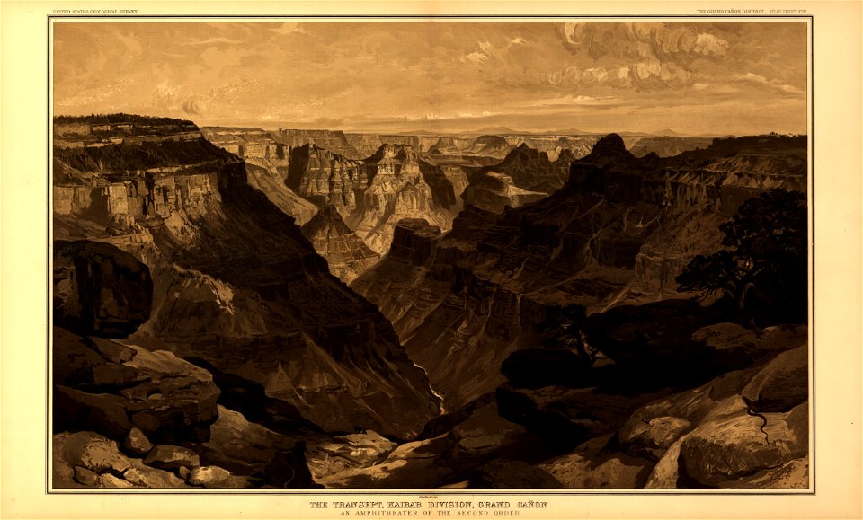
tertiary history of the grand cañon district
..
with atlas
maps made in the 17th century
geographical illustrations by coronelli
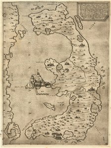
old maps of the peloponnese
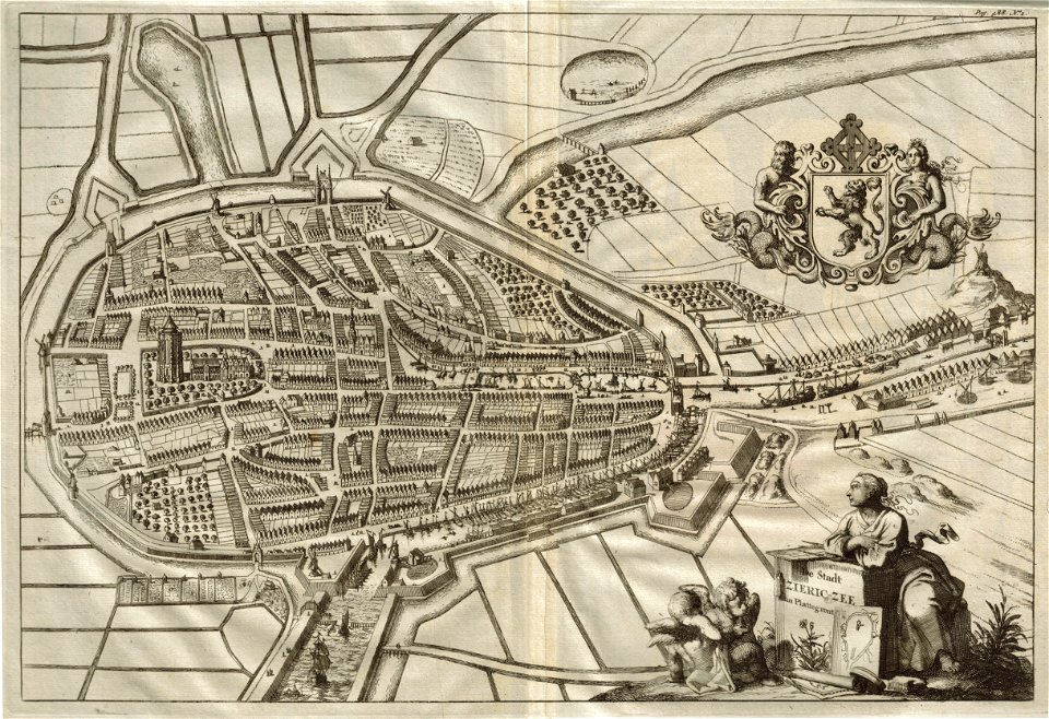
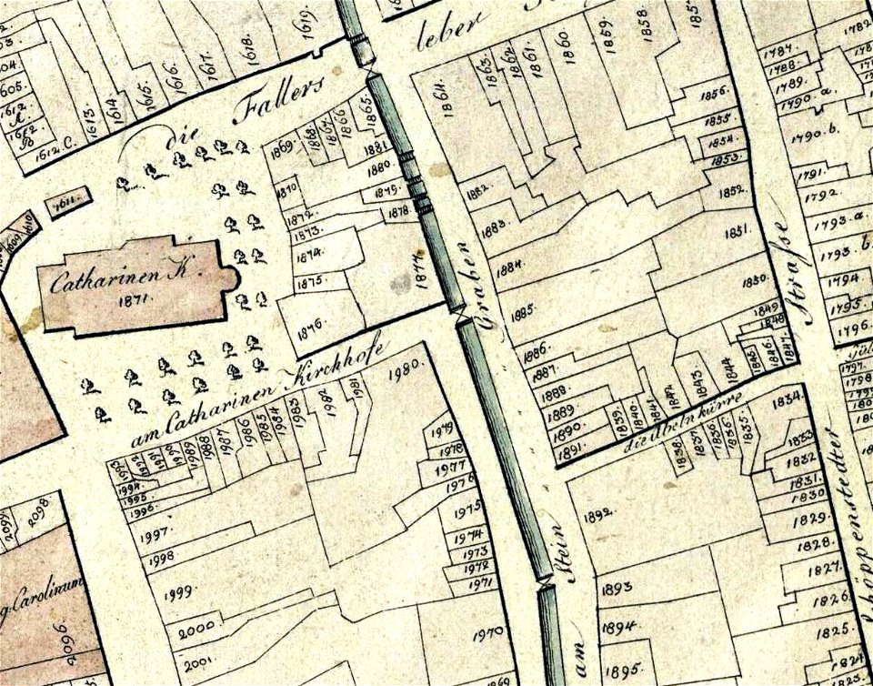
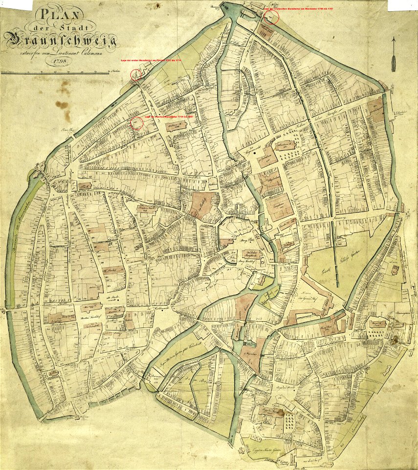
old maps of braunschweig
collections of stadtarchiv braunschweig
braunschweig in the 1790s
old maps of the hague
the hague
atlantis magni tomus primus (biblioteca comunale di trento)
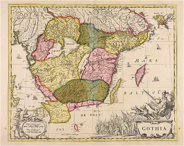
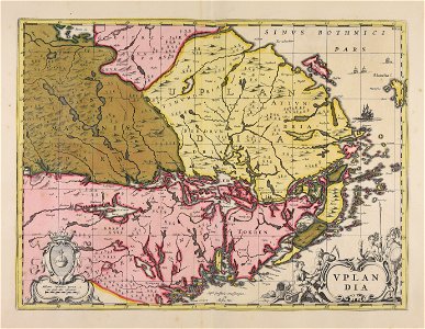
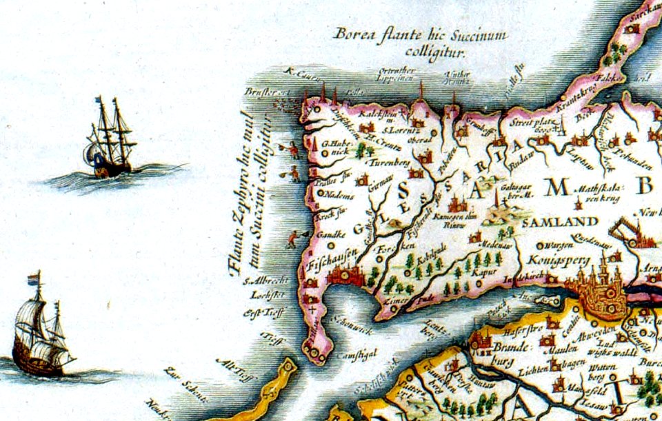
17th-century maps of sweden
coats of arms on maps
bethmann family
university of toronto wenceslas hollar digital collection
hollar maps and plans of london
maps and topographical views by joris hoefnagel
drawings by joris hoefnagel
university of toronto wenceslas hollar digital collection
hollar maps and plans of london
geographical illustrations by coronelli
old maps of the peloponnese
engravings by jan luyken
1696
collections of stadtarchiv braunschweig
old maps of braunschweig
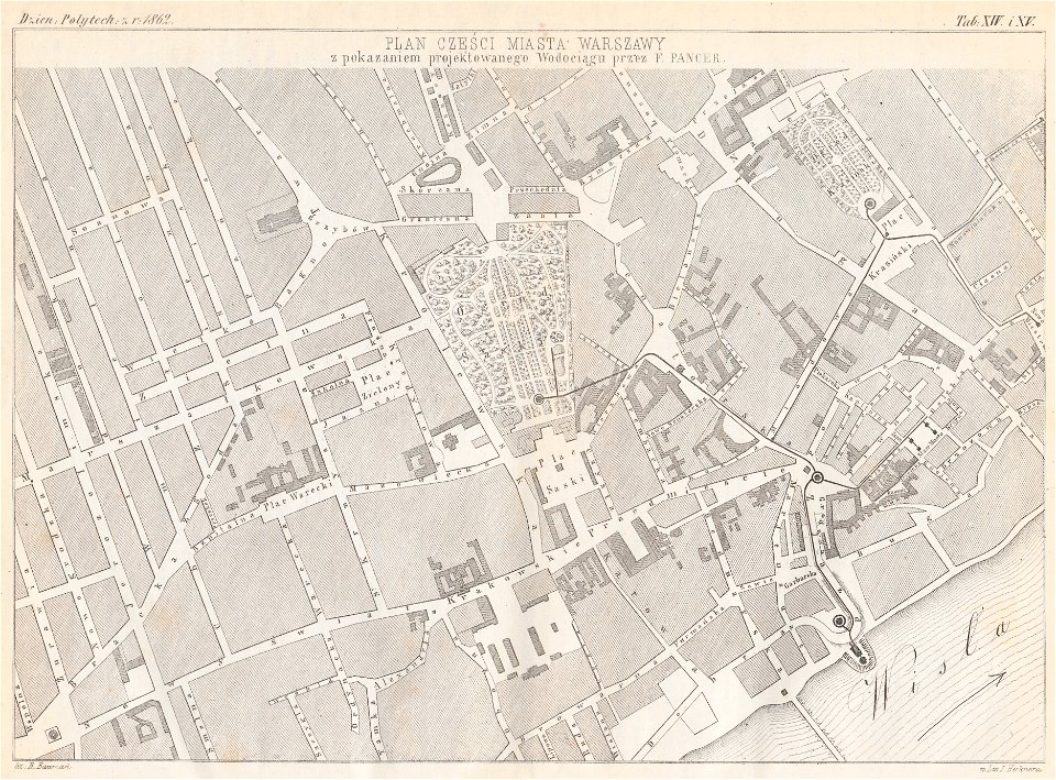
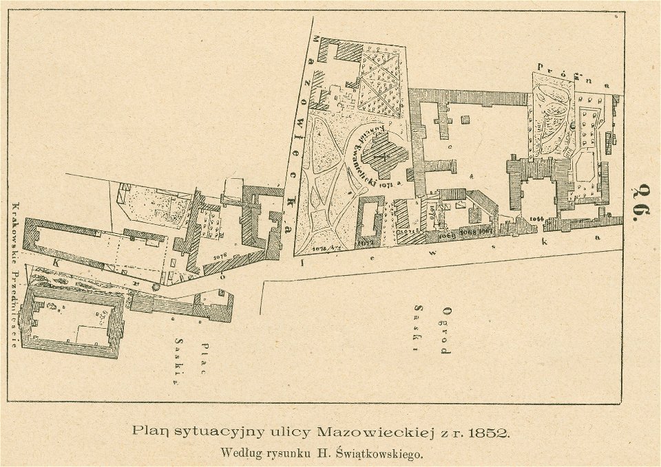
warsaw in the 1860s
feliks pancer
królewska street in warsaw
historical maps of warsaw
collections of stadtarchiv braunschweig
old maps of braunschweig
collections of stadtarchiv braunschweig
old maps of braunschweig
atlantis magni tomus primus (biblioteca comunale di trento)
17th-century maps of sweden
ämteratlas des fürstentums lüneburg von johannes mellinger
elbe in lower saxony
engravings by matthäus merian
historical maps of plzeň
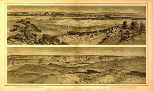
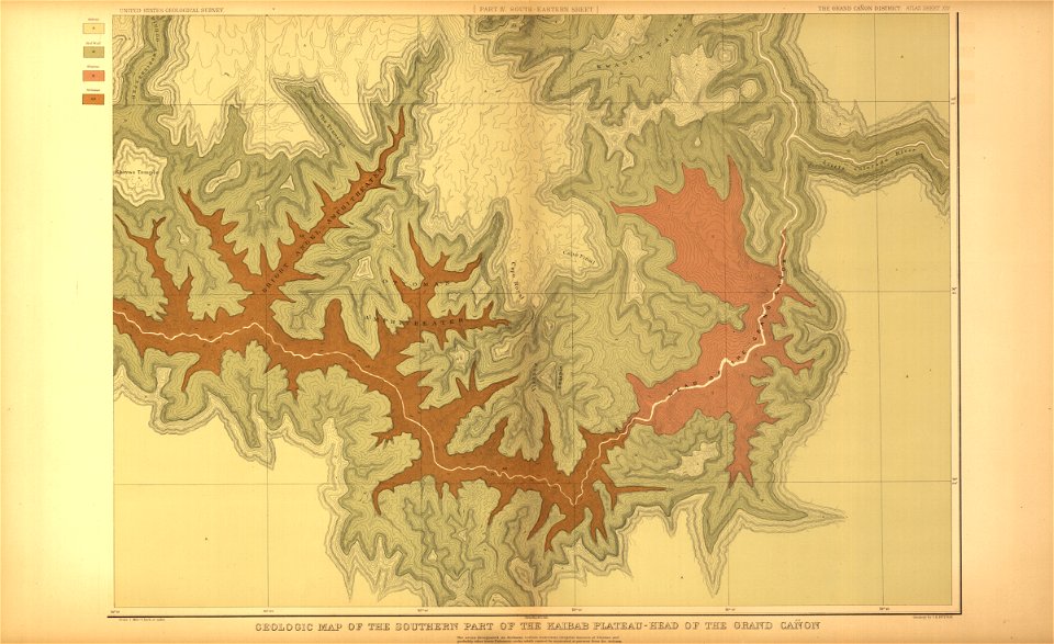
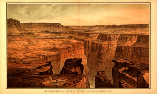
tertiary history of the grand cañon district
maps in the library of congress
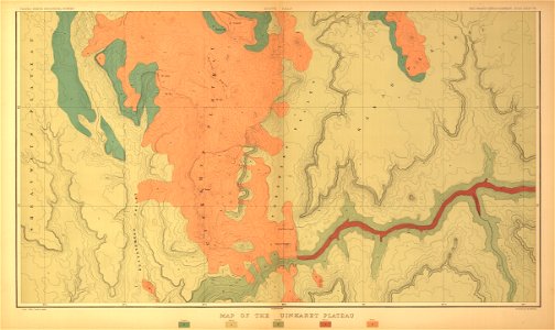
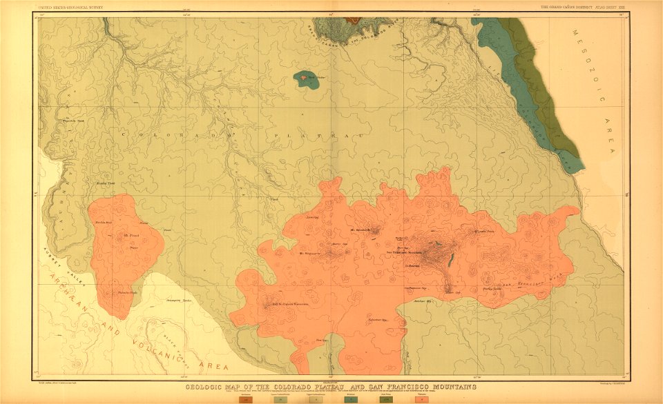
tertiary history of the grand cañon district
maps in the library of congress
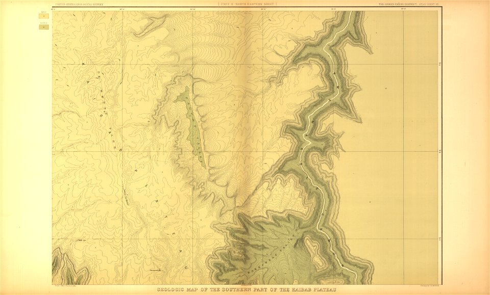
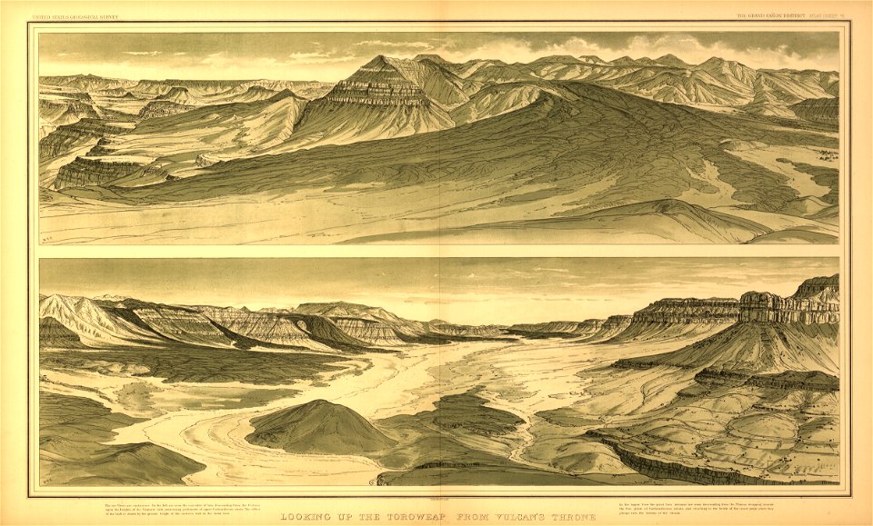
tertiary history of the grand cañon district
maps in the library of congress
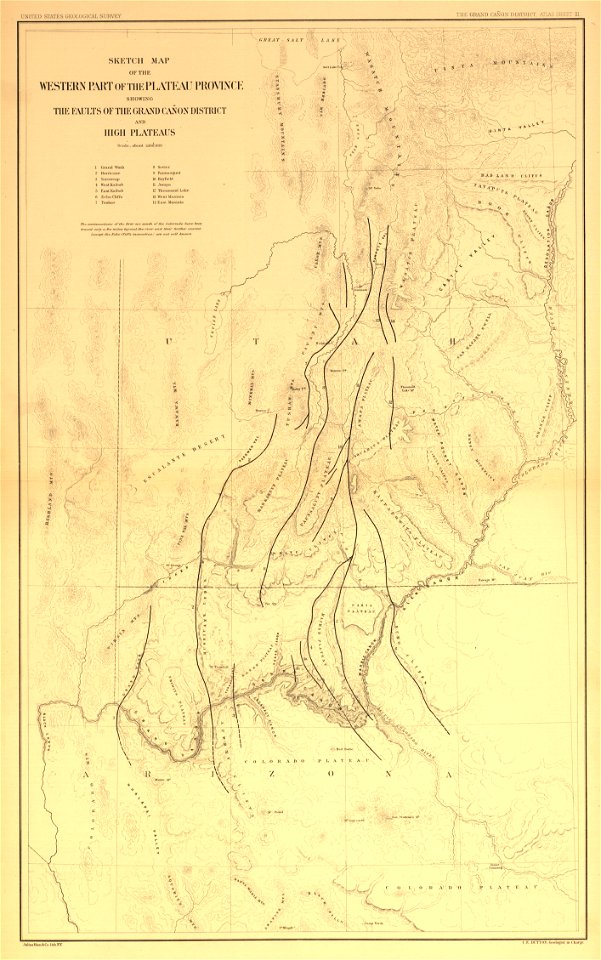
tertiary history of the grand cañon district
maps in the library of congress
tertiary history of the grand cañon district
maps in the library of congress
tertiary history of the grand cañon district
maps in the library of congress
tertiary history of the grand cañon district
maps in the library of congress
tertiary history of the grand cañon district
maps in the library of congress
tertiary history of the grand cañon district
maps in the library of congress
tertiary history of the grand cañon district
maps in the library of congress
drawings and watercolours of the royal museums greenwich
printing
tertiary history of the grand cañon district
maps in the library of congress
tertiary history of the grand cañon district
maps in the library of congress
collections of stadtarchiv braunschweig
old maps of braunschweig
collections of stadtarchiv braunschweig
old maps of braunschweig
fontaine de la croix du trahoir
tour de nesle
megalithic temples of malta
old maps of malta
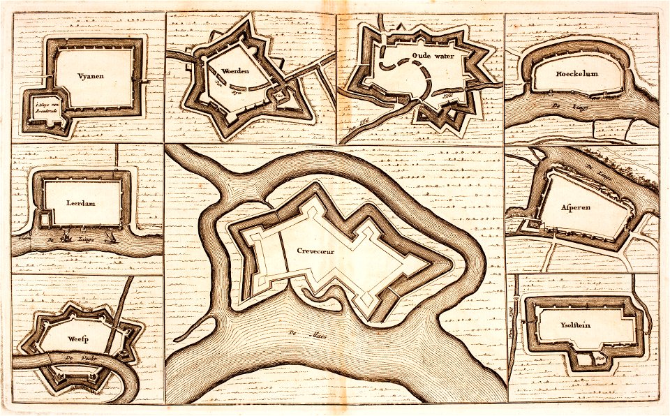
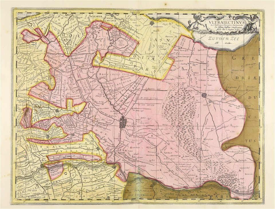
utrecht
leerdam
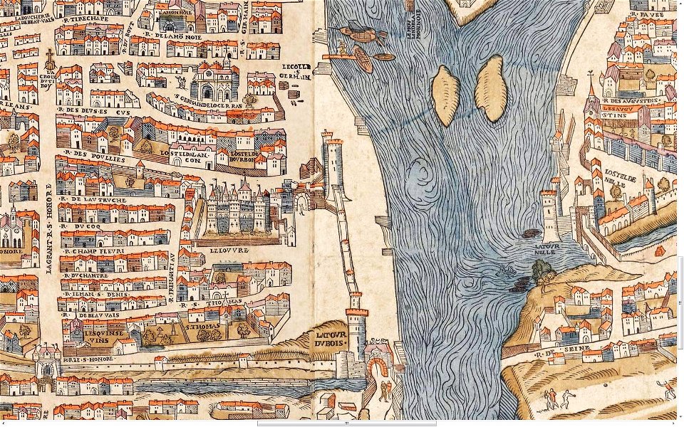
lithographs of paris
floor plans of paris
history of spalding
river welland
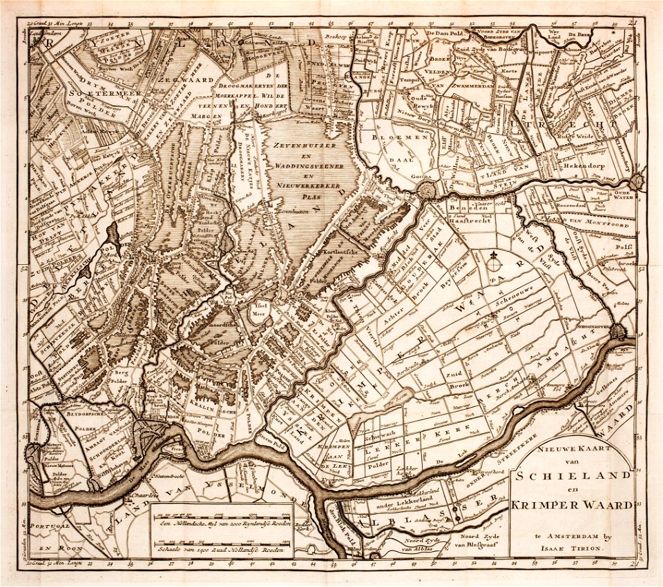
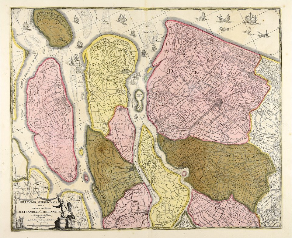
1760s maps of the netherlands
old maps of south holland
historical images of the pont saint-michel
lithographs of paris
images from metropolitan museum of art (paris project)
1842 in paris
historical images of pont neuf
lithographs of paris
cornell university library
gibson girl
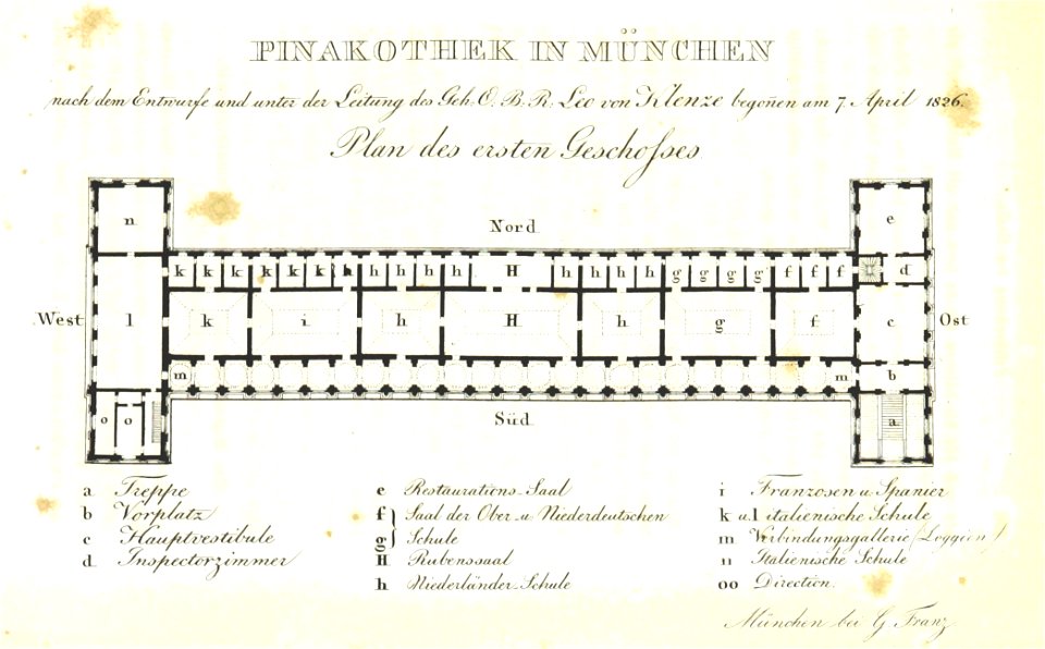
munich in the 19th century
alte pinakothek
coats of arms of the tsardom of russia
crowned double-headed eagles
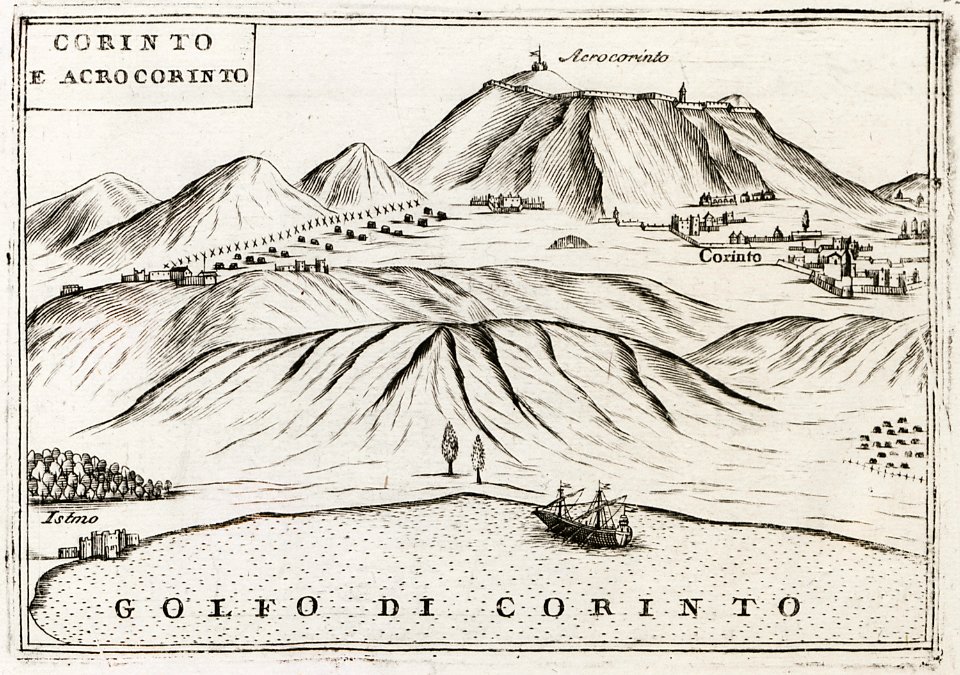
geographical illustrations by coronelli
remote views of acrocorinth
atlantis magni tomus quintus (biblioteca comunale di trento)
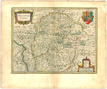
maps made in the 17th century
media contributed by agad presented in former polska.pl portal
maps of the history of breslau (wrocław)
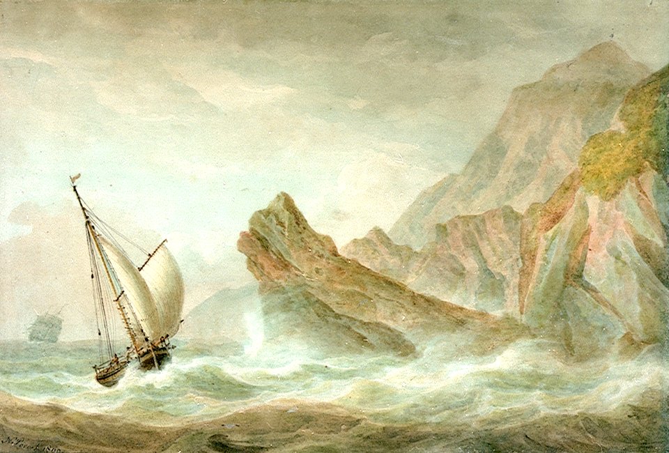
sea storms in art
1737
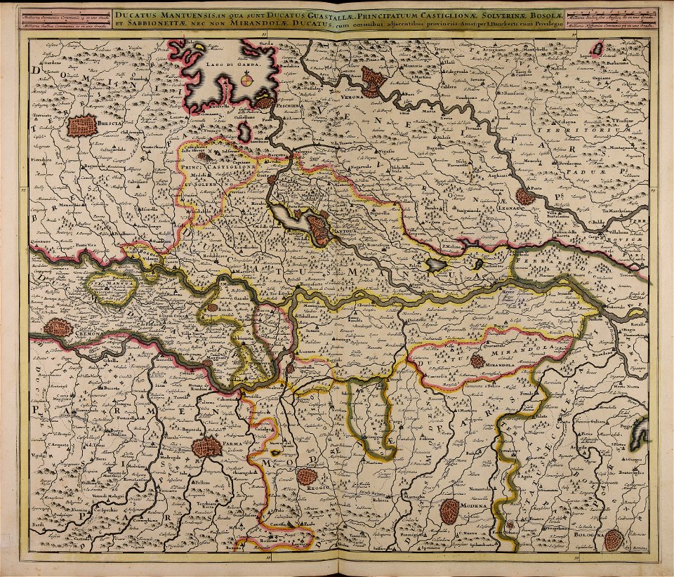
atlantis magni tomus quartus (biblioteca comunale di trento)
maps made in the 17th century
atlantis magni tomus quartus (biblioteca comunale di trento)
maps made in the 17th century
atlantis magni tomus secundus (biblioteca comunale di trento)
maps made in the 17th century
atlantis magni tomus quartus (biblioteca comunale di trento)
maps made in the 17th century
maps in portrait paintings
lounge suits in art
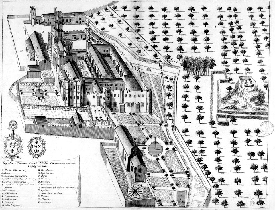
monasticon gallicanum
puy-de-dôme in art
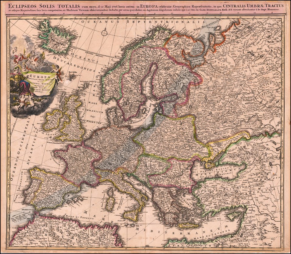
johann baptist homann
1706 maps of europe
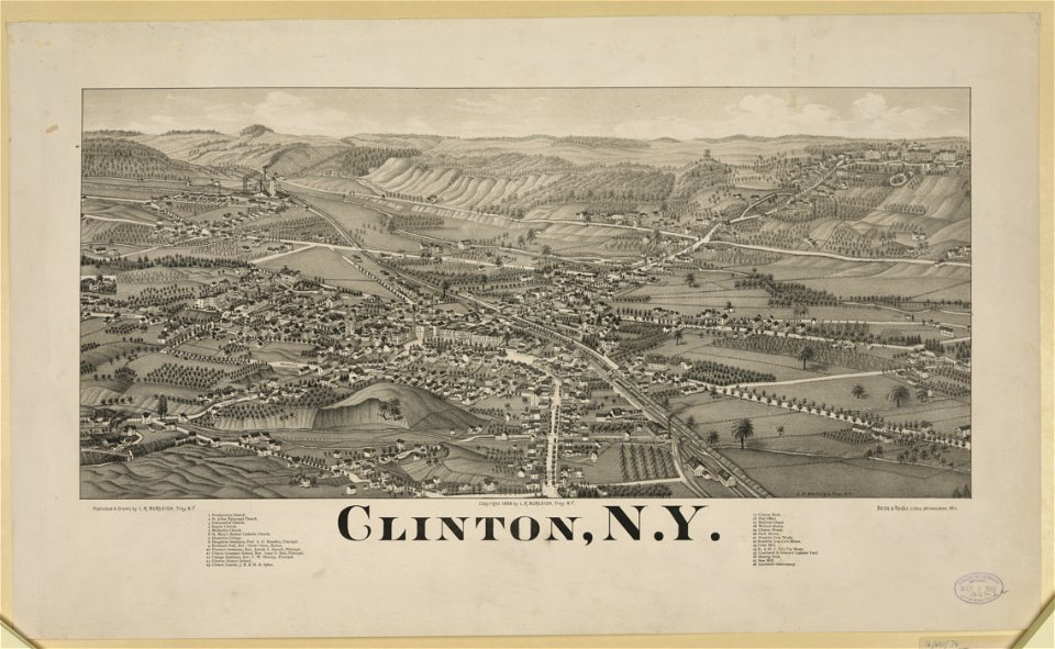
new york
clinton
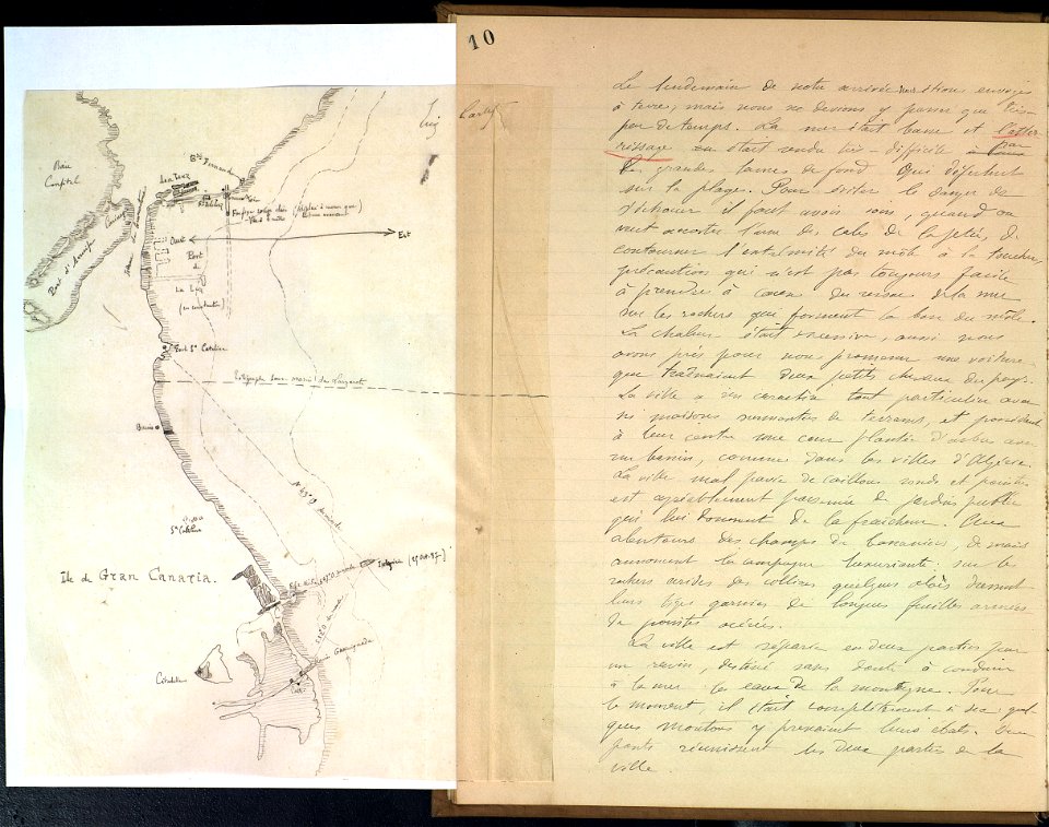
journal de relâches du croiseur ecole d'application l'iphigénie : campagne 1887-88
cartography
theatrum orbis terrarum (london 1606)
files from the bodleian libraries
maps by gerardus mercator
mercator celestial globe
old maps of florence
florence in art
alpstein
säntis
drawings and watercolours of the royal museums greenwich
printing
images from bristol past and present (1882)
bristol
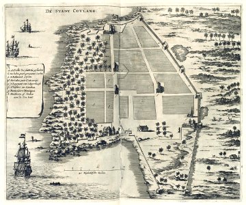
maps of the dutch east india company - india
1672
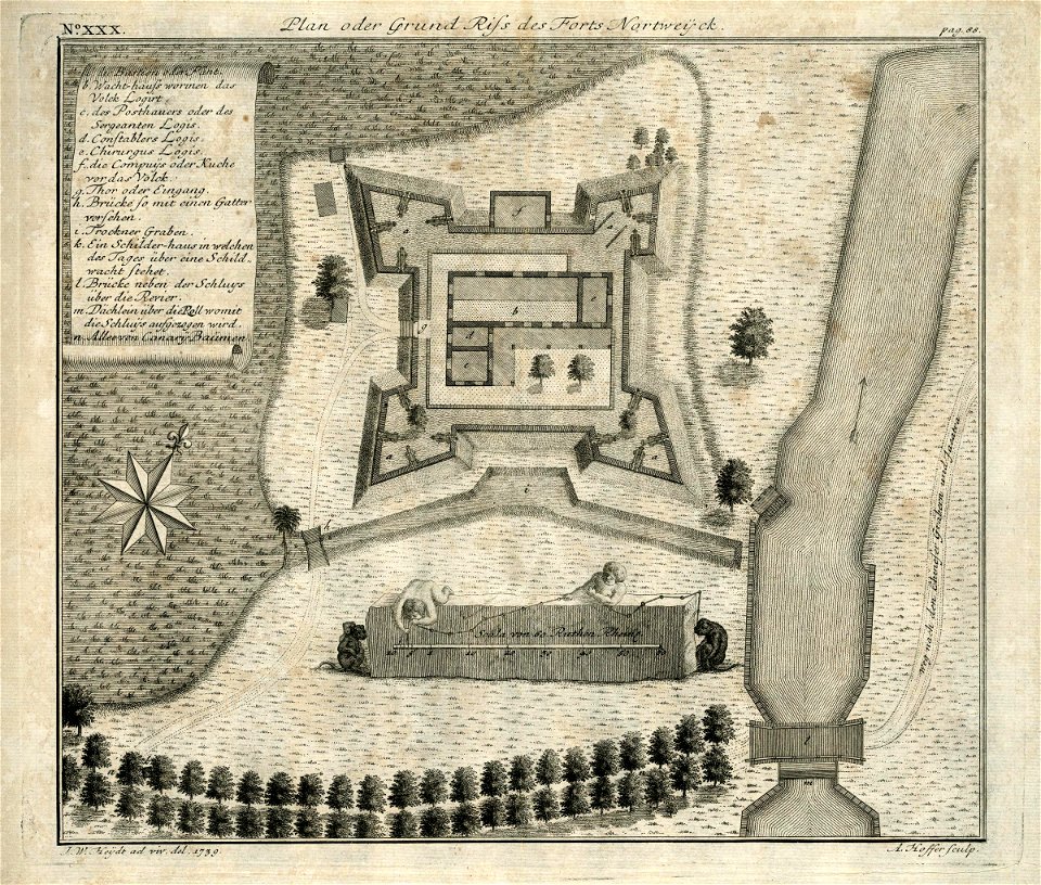
maps of the dutch east india company - indonesia
1739
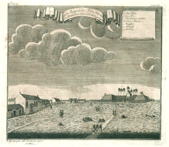
media from atlas of mutual heritage on dutch east india company
1736
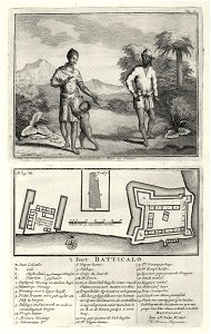
ottomar elliger (ii)
1726
maps of the west-indische compagnie
1773
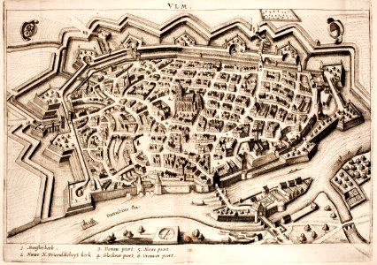
historical maps of ulm
history of ulm
illustrations of cosmographia (münster)
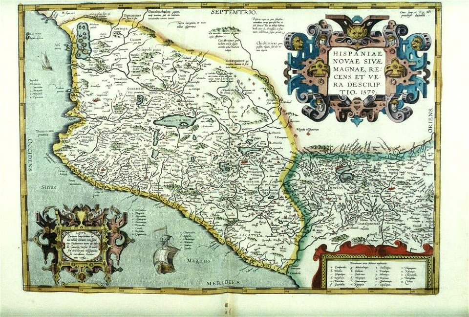
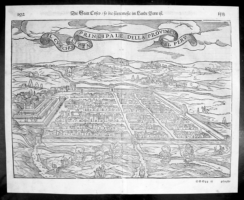
old maps of the viceroyalty of peru
braun & hogenberg
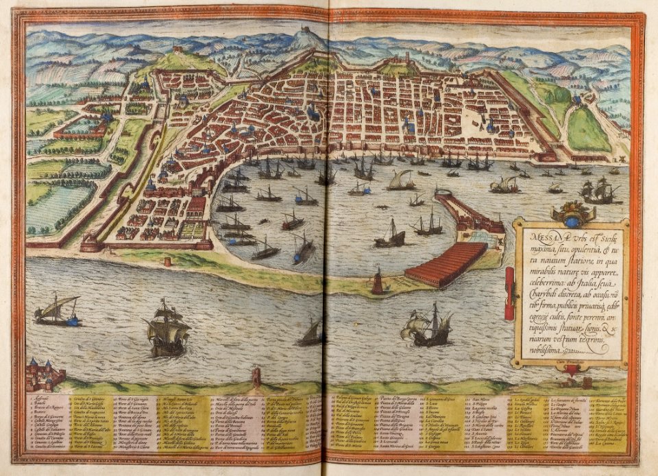
historic port
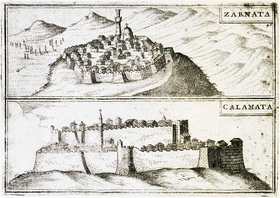
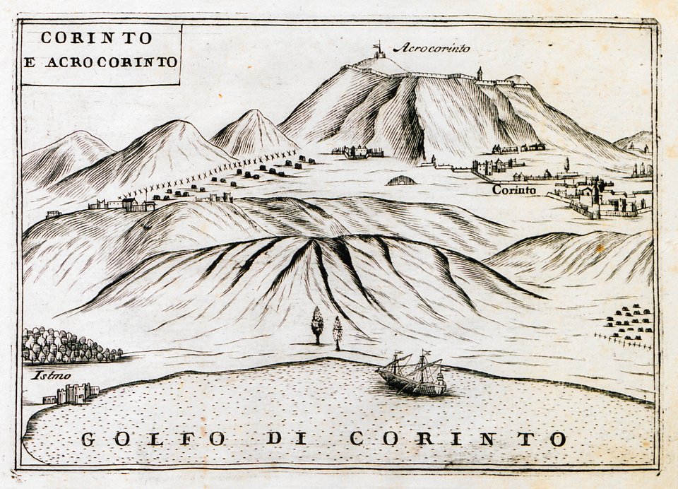
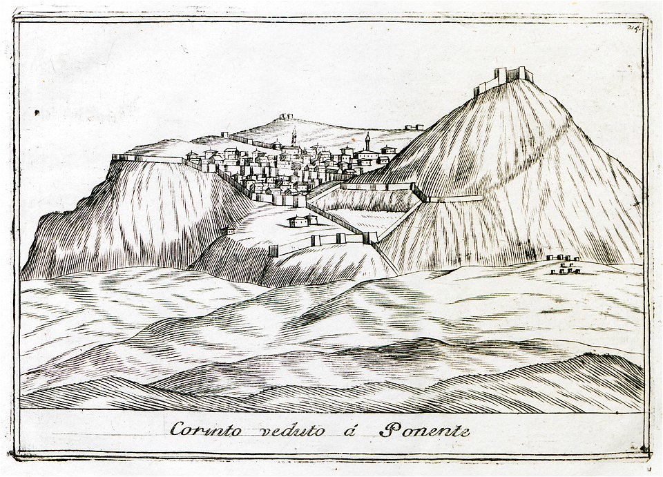
geographical illustrations by coronelli
remote views of acrocorinth
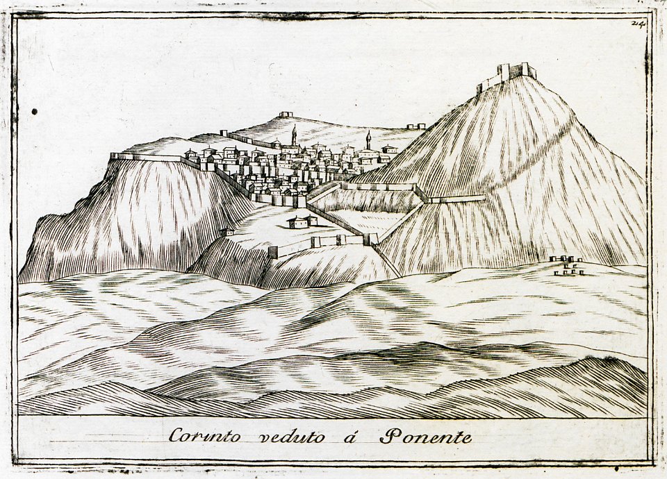
geographical illustrations by coronelli
remote views of acrocorinth
geographical illustrations by coronelli
remote views of acrocorinth
geographical illustrations by coronelli
remote views of acrocorinth
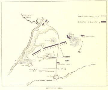
maps from the mechanical curator collection
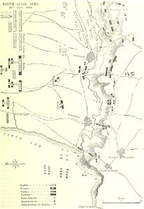
british battles on land and sea
british battles on land and sea
battle of the alma
johann christoph brotze
old maps of riga
johann christoph brotze
old maps of riga
drawings in the universitätsbibliothek salzburg
maps made in the 17th century
atlas van der hagen
copper engraving
atlas van der hagen
brigittenau
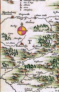
badonviller
blâmont
illustrations from second fatherland by george roux
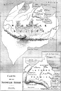
maps of fictional islands
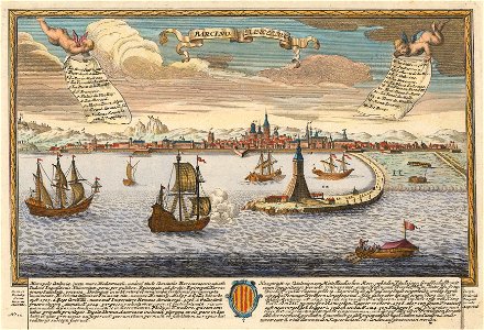
historical images of port of barcelona
maps by joseph friedrich leopold
collections of the musée jean-frédéric oberlin
ban de la roche
17th-century maps of maastricht
siege of maastricht (1632)
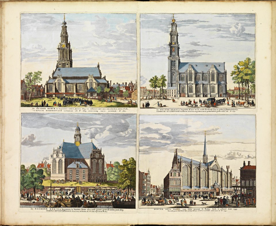
historical images of zuiderkerk (amsterdam)
frederick de wit
atlas de wit 1698
frederick de wit
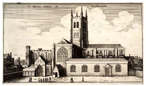
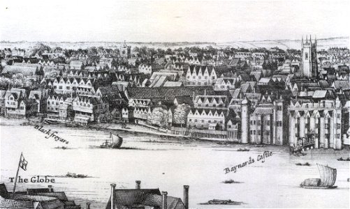
1647 in london
landscape art
old maps of gibraltar
history of gibraltar
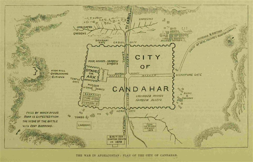
kandahar in the 19th century
battle of kandahar
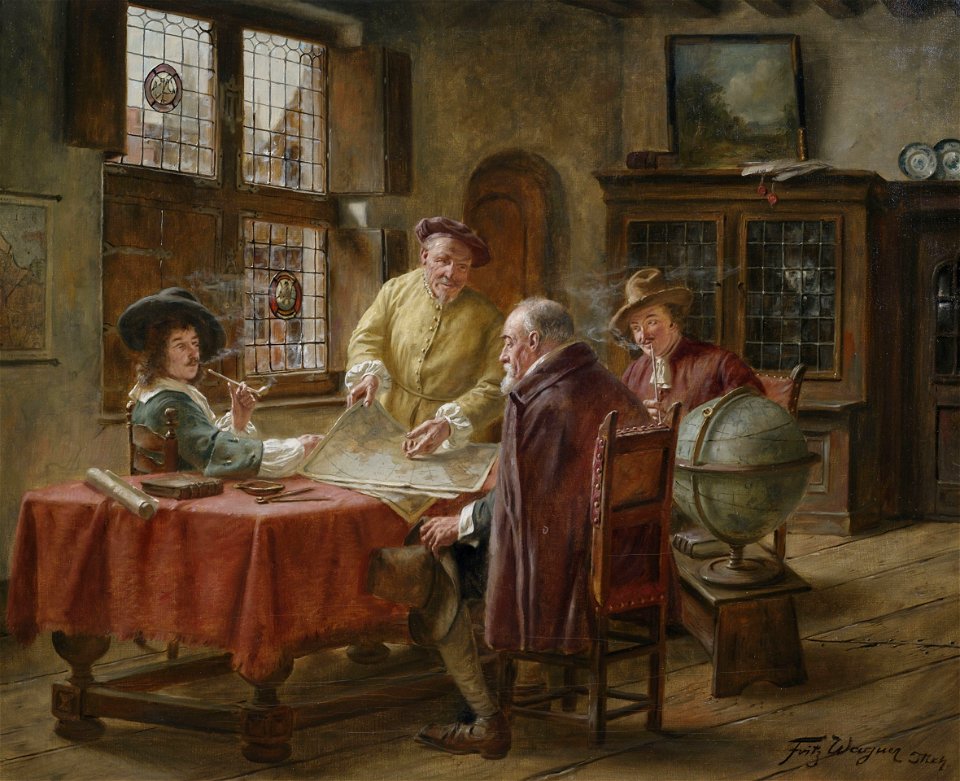
people with globes in art
people with maps in art
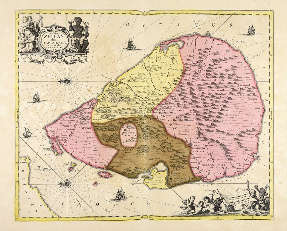
maps made in the 17th century
sri lanka
prints from isaak tirion hedendaegsche historie at the peace palace library
old maps of south holland
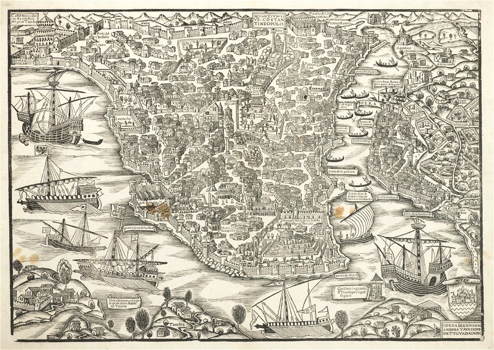
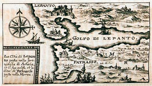
turkey in the 16th century
harvard university
atlantis magni tomus secundus (biblioteca comunale di trento)
maps made in the 17th century
atlantis magni tomus secundus (biblioteca comunale di trento)
maps made in the 17th century
harvard university
ferrando bertelli
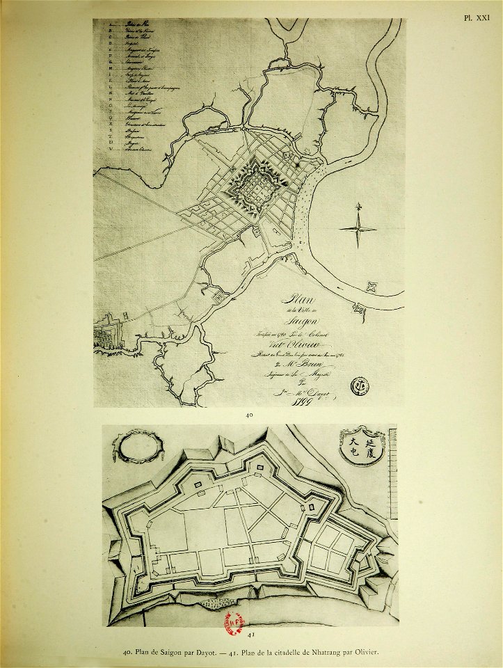
old maps of vietnam
sài gòn
kurtze beschreibung von republick venedig
17th-century engravings of towns
9301 - 9400 of 35,787
Next page
/ 358